Where the land rises faster than the sea
At first glance it's a paradox: While globally sea levels are rising, they’re sinking in Scandinavia, Greenland, Canada and Alaska. And also more recently in Iceland.

This is shown by an analysis of 365 measurement points over a period of 50 years, from 1961 to 2011. Some of the levels in the northern hemisphere are falling with astonishing speed: In certain areas of Alaska and Canada, the sea level falls by up to two centimetres per year. On the coasts of Norway, Sweden and Finland it falls by 0.7 centimetres per year. The explanation: It is not the sea level that’s falling, it is the land that’s rising. Because the glaciers are melting and the immense weight of their ice mass has disappeared. And that is why the land rises.
The phenomenon has long been known in Scandinavia. In Iceland, it’s new. In 2015, an international team of scientists published a study that showed that parts of the central highlands of Iceland rise by more than three centimetres per year. Recent measurements of the national land survey authorities show a rise by one and a half centimetres in certain coastal areas.
The reason: The glaciers that once covered approximately 11 per cent of Iceland’s land mass have shrunk dramatically in recent decades. It’s predicted that they’ll be gone completely in about 200 years time.Many countries will shrink due to climate change and the rise in sea levels. “Iceland will first grow,” says Páll Einarsson, professor at the Institute of Earth Sciences at the University of Iceland. Einarsson was one of the first who explored the phenomenon in the early 1990s. “We were stunned when we started with the measurements. Meanwhile, the land elevation is taking place at a rate much faster than we had anticipated.”
In Scandinavia, the land has been rising for a long time; it is called the “Fennoscandian land elevation”. In 1491 the residents of a settlement called Östhammar were already complaining that the coast had pulled back from the city so far that the old port had become unusable. The people at that time had no explanation for it. They suspected the sea would drain, the sea levels fall. Over the centuries, several other ports became dry, and new ones had to be built.
“During the last glacial period, one single big glacier covered what is today Scandinavia,” explains Sven Knutsson, Professor of Soil Mechanics at the Technical University of Luleå in Sweden. In its center, the glacier was about 3,000 metres thick, and its immense weight pressed the ground down. As the ice retreated about 10,000 years ago, the ground began to lift. This post-glacial uplift continues today — up to nine millimetres each year.
Professor Knutsson emphasizes how much difference this makes — especially along a coast where the water is not very deep. “This means that we are talking about a land elevation of half a metre to one metre during a person’s lifetime.”
But there are exceptions which seem difficult to understand at first glance. Some stations on the Norwegian and Swedish coast show sea levels rising up to one millimetre per year. The explanation: These areas are the furthest away from the old Fennoscandian glacier. The land here rises only 1 to 2 millimetres per year, and sea levels rise around 3 millimetres each year globally- so the net effect is that the sea level increases slightly.
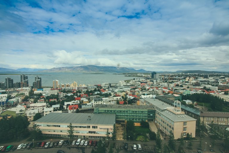
Reykjavík is another exception. Here, the sea level increased by about 2.1 millimetres per year between 1961 and 2011. The explanation: While individual parts of Iceland rise by up to three centimetres per year, the land below the capital falls due to tectonic movement. Since the launch of GPS measurements in 2007 the land around Reykjavík fell by about two millimetres per year.

Reykjavik
unsplash.com / Tim Trad
If global sea levels rise by about 3 millimetres per year, and Reykjavík falls by about two millimetres per year — the sea level would actually increase by 5 millimetres per year. However, it is only 2.1 millimetres. Why?
The explanation is provided by Stefan Rahmstorf of the Potsdam Institute for Climate Impact Research: The ice cap at the North Pole is melting due to climate change and is getting smaller. This also reduces its gravity. The water — gradually — withdraws from the North Pole, which is why countries like Greenland, Iceland, and even Scotland and Alaska, are experiencing a decline in sea levels along their coasts.
For now. In the medium term, when the global levels continue to rise, this effect will diminish — and the northern countries will experience a rise in sea levels too.


